


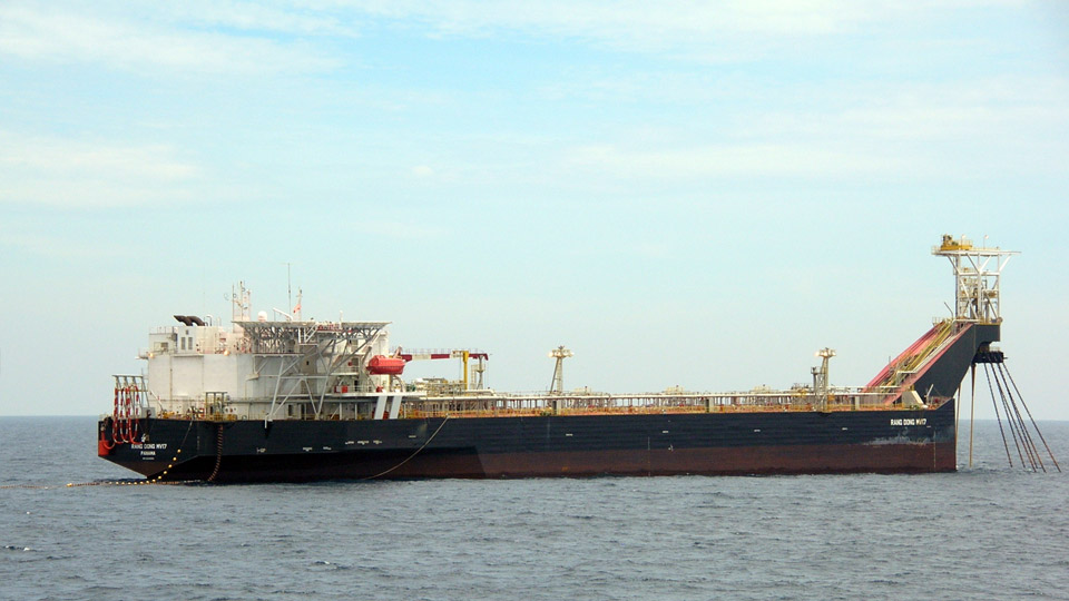


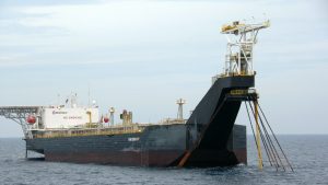
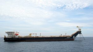

FSO Rang Dong MV17
A. Introduction
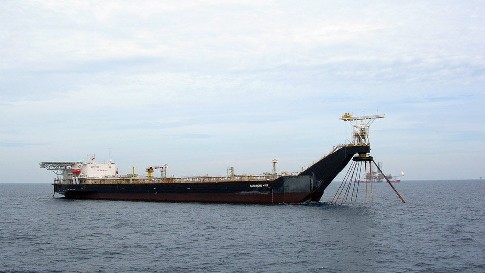
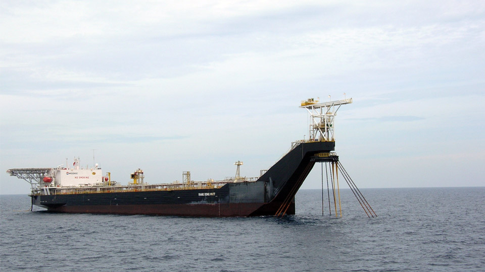
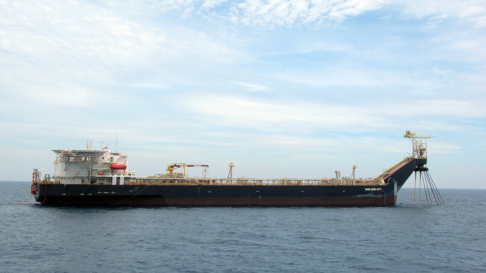
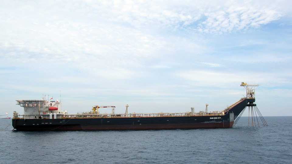
FSO “Rang Dong MV17”
Location:
The FSO “Rang Dong MV17” is located offshore VietNam, the position of Lat. 10°01’12.62”N and Long. 108°16’08.29”E.
Navigation charts and publications for the area are as follows:
- British Admiralty Chart numbers 3986, 1216 and 2660А;
- China Sea Pilot Volume 1.
Description
| TYPE: | Floating Storage and Offloading System |
| CLASSIFICATION: | ABS |
| PORT OF REGISTRY: | Panama |
| OFFICIAL NUMBER: | 37128-TJ |
| CALL SIGN: | 3EQR9 |
| DISPLACEMENT: | 65,721 tonnes |
| DEADWEIGHT: | 50,500 DWT |
| BUILD DATE: | 2008 |
The Terminal consists of the tanker-shaped floating storage and offloading system, FSO “Rang Dong MV17”, moored by means of a single point mooring installed at the bow. The Terminal is designed to accept Offtake Tanker up to 150,000 DWT. The FSO “Rang Dong MV17” has export quality crude oil storage capacity of approx 56,160 m3 (at 98%, excluding slop tanks) and contains equipment necessary for dehydration, storage and transshipment of crude oil. The Terminal is loading crude oil continuously from the WHPs.
During the hours of darkness the FSO “Rang Dong MV17” will show lights with the distinctive characteristics of the Morse code letter “U”. In periods of poor visibility the fog signal sound the Morse code for the letter “U”.
B – Recommendations for Export Tankers approaching Rang Dong MV 17:
- Contact Terminal for permission to enter MEZ at least 10 NM away from FSO on VHF CH 16/68; FSO’s Call Sign: MV 17.
- Without Pilot/Mooring Master/Terminal Rep. on board, all vessels are requested to keep a safe distance (at least 2 NM) from the following installations within MEZ (see attached sketch):
-
CPC (Fixed): 9°59’54.21”N 108°16’07.13”E -
WHP-C1(Fixed): 9°57’44.32”N 108°15’26.81”E -
WHP-E1/E1A(Fixed): 9°58’56.81”N 108°17’38.52”E -
WHP-S1(Fixed): 9°56’45.04”N 108°13’42.23”E -
WHP-PD: 10°04’13.00”N 108°24’28.00”E
-
- A mooring team of 6 to 7 persons will come on board Export Tanker for offloading operation. Before the team coming aboard, to save time for preparation the following should be ready:
- Pilot combination ladder on lee side (agreed with Operation Supervisor or Mooring Master); height: 1.5m over sea level.
- Ship crane: to pick up the toolbox from Supply Boat. Crane runner must be connected by a stinger with safety latch hook (length: 2.0-3.0m) and tag lines in case of bad weather.
- Oxygen analyzer: to check oxygen in loading tanks before offtake under the witness of Mooring Master or his delegate.
- Deployment of Tanker’s messenger line: 24-36 mm diam. x 220 M rope to be arranged (see attached Sketch) for Boatless Hose Transfer. The Aft maindeck windlass (in front of Accommodation Block) must be empty and ready to heave.
- On Forecastle: winch drum with direct lead to the 76mm chain stopper must be empty to accept a 220 metres of 24-36mm messenger and 150 metres of 72mm pick-up line of the tandem mooring system. Just a short messenger 24-36mm x 30-50m to be connected to winch drum and ready to use. 1 crowbar, 1 hammer to be ready.
- On poop deck: Aft poop deck windlass, 2 heaving lines, 1 chain stopper, 1 plier, 1 crowbar, 1 hammer must be ready for picking up towing pendant wire.
- In case of bad weather and request of deviation is granted, the pilot boarding ground is Mui Vung Tau (10°15’N; 107°05’E). Please contact Vung Tau Port Control on VHF 16/09 from distance 24NM, 12 NM, 6 NM to the POB point for more information and instructions.

Download Document
- 01/03/2024 Rang Dong Terminal Regulations
- 15/12/2023 Material Safety Data Sheet
- 20/10/2014 Rang Dong MEZ
- 10/03/2014 BoatLess Cargo Hose Transfer
WARNING:
* All information of our projects are issued and permitted to post on this website by the Terminal Operators or our Clients. MM Marine is not responsible for any errors, omissions and consequences of the accuracy of these documents. The map, diagrams included are for reference only, they should not be used for ship’s navigation to approach, inbound/outbound or transiting Terminal areas