


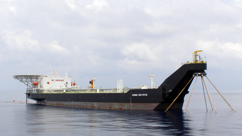


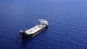
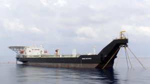


FSO MV12 (RONG DOI-KNOC)
A. Introduction
Rong Doi (Twin Dragon) – Rong Doi Tay (Twin Dragon West) Terminal located in Block 11-2 of the Nam Con Son Basin offshore Vietnam, 172 Nautical Miles (320Kms) South East of Vung Tau City. The Nam Con Son Basin has several important oil and gas fields with production from Dai Hung oil field, Lan Tay gas filed.
KOREA NATIONAL OIL CORPORATION (KNOC) is the Operator of Block 11-2, and MODEC INC. operates the FSO RONG DOI MV12 on KNOC’s behalf.
Rong Doi will be comprised of the following:
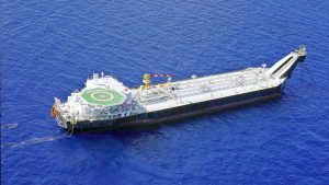
- A Floating Storage and Offloading (FSO) system.
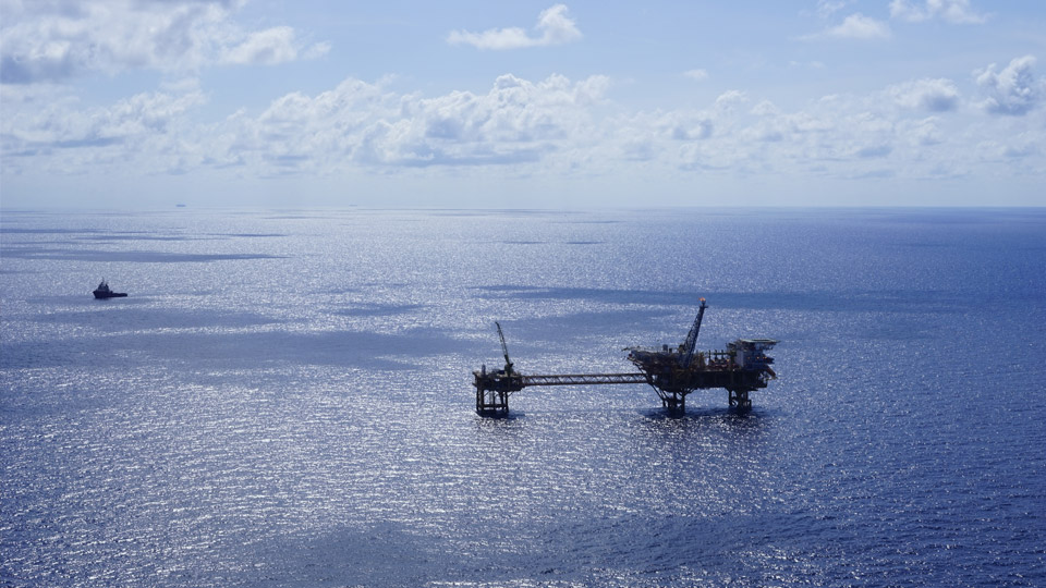
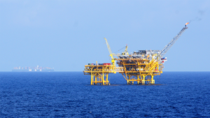
- A Well Head Platform (WHP)
- Processing Utilities Quarters Compression (PUQC)
- A Sub-sea Pipeline End Manifold (PLEM)
- Infield flow lines
- Associated gas will be separated on the Processing Utilities Quarters Compression. The separated gas will be delivered to the Nam Con Son pipeline through the 58Kms x 18″ sub-sea pipeline, and Condensate will be piped through the infield and 6″ flexible risers to the FSO and to be stored and offloaded from the FSO. The FSO located approximately 2.5 km NW from the PUQC.
B. Terminal Limits, Anchorage, Aids To Navigation
Terminal Limits
The gas field facilities are in the following coordinates:
| FSO | Lat. 07°48’32”N | Long. 108°11”08”E |
| WHP & PUQC | Lat. 07°47’33”N | Long. 108°12”08”E |
Gas pipe line location:
| Tie-in point at Platform: | Lat. 07°47’33”N | Long. 108°12’08”E |
| Tie-in point at NCSP connection: | Lat. 08°10’29”5N | Long. 108°33’05”2E |
Safety Zones:
There are 02 Safety Zones established:
- a prohibited area has been established bounded within a 500 meter radius from a line joining between the WHP and FSO positions
- 02 areas formed by extending 500m from outer edges of WHP and FSO, Vessels shall not enter these areas without a Mooring Master on board.
Restricted Zones:
- There are 02 Restricted Zones with radius of 3 Nautical Miles surrounding WHd and FSO. Within a restricted zone, anchoring of vessel(s) is strictly prohibited.
- Drop anchor within 2 Nautical Miles along the gas pipe line is strictly prohibited.
Pilot embarking/disembarking area:
- In case of weather permitting, the vessel(s) is requested to call to below position for embarking/disembarking Pilot and loading group
Lat. 07°48’32”N Long. 108°07’03”E - In case of rough sea, the vessel(s) is requested to deviate to off Vung Tau pilot station as below position for embarking/disembarking Pilot and loading group
Lat. 10°16’N Long. 107°04’E
Anchorage Area:
For vessel(s) requesting to anchor, the recommended area is located West of the field and is centered on the following position:
| Latitude: | 07°48’32”N |
| Longitude: | 108°07’03”E |
This position represents the center of a circle with a radius of 1 NM.
Holding/anchoring ground within this predetermined area is considered good.
Anchoring within the terminal limits is strictly prohibited. The sea water depth around the area is approximately 85m.
Aids to Navigation
Both the FSO and WHP are provided with navigation lights Morse “U” and complies with IMO.
Nautical Charts and Publication for the area as follows;
British Admiralty (BA) Chart Number 3482 for approach Rong Doi terminal. BA Chart Numbers 3986, 1261, 1016 for approach off Vung Tau Pilot Station.
The Navigator is referred to published sailing instruction for the area through British Admiralty China Sea Pilot Vol.1
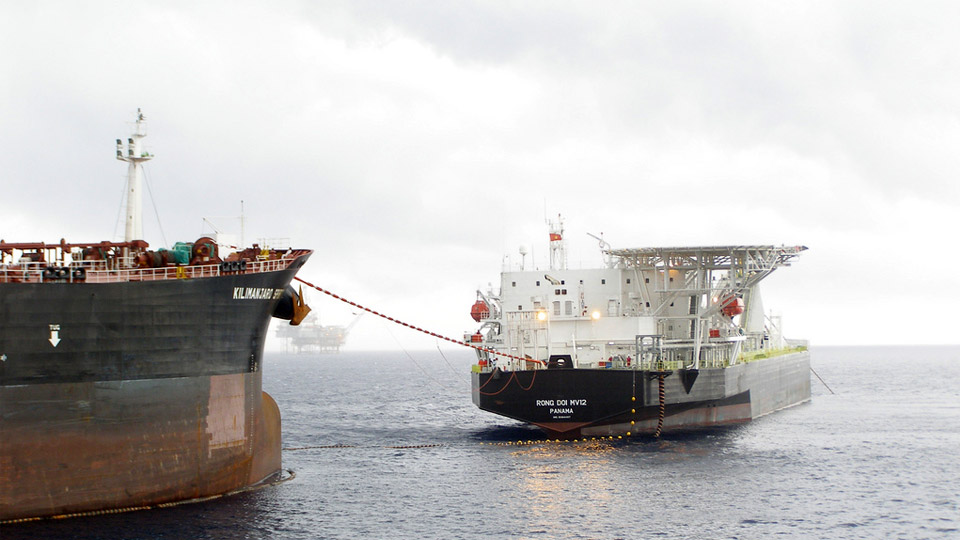
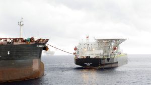
C. Recommendations for Export Tankers approaching Rong Doi MV 12 for offloading operation:
- Contact Terminal for permission to enter MEZ at least 10 NM away from FSO on VHF CH 16/06 (for FSO); FSO’s Call Sign: MV 12.
- Without Mooring Master on board, all vessels are requested to keep a safe distance (at least 2 NM) from the following installations within MEZ:
FSO Lat. 07°48’32”N Long. 108°11’08”E WHP & PUQC Lat. 07°47’33”N Long. 108°12’08”E - A mooring team of 5 to 6 persons will come on board Export Tanker for offloading operation. Before the team coming aboard, to save time for preparation, the following should be ready:
- Pilot combination ladder on lee side (agreed with Operation Supervisor or Mooring Master); height: 1.5m over sea level.
- Ship crane: to pick up the toolbox from Supply Boat. Crane runner must be connected by a stinger with safety latch hook (length: 2.0-3.0m) and tag lines in case of bad weather.
- Oxygen analyzer: to check oxygen in loading tanks before offtake under the witness of Mooring Master or his delegate.
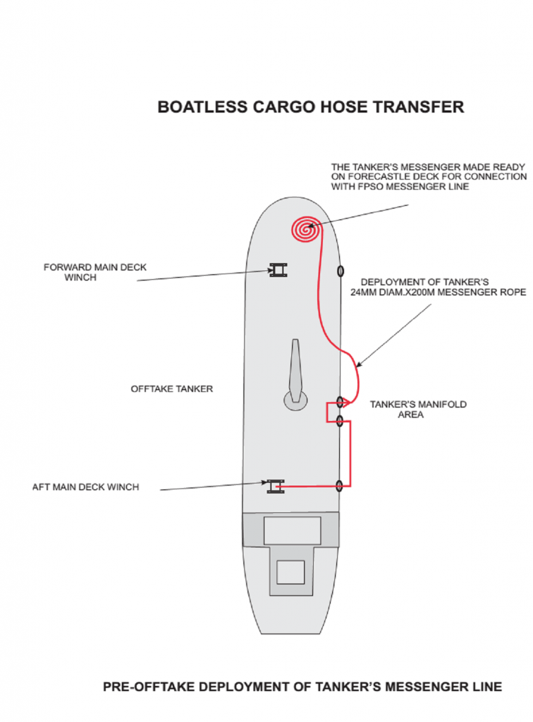
- Deployment of Tanker’s messenger line: 24-36 mm diam. x 220 M rope to be arranged (see attached Sketch) for Boatless Hose Transfer. The Aft maindeck windlass (in front of Accommodation Block) must be empty and ready to heave.
- On Forecastle: winch drum with direct lead to the 76mm chain stopper must be empty to accept a 220 metres of 24-36mm messenger and 150 metres of 72mm pick-up line of the tandem mooring system. Just a short messenger 24-36mm x 30-50m to be connected to winch drum and ready to use. 1 crowbar, 1 hammer to be ready.
- On poop deck: Aft poop deck windlass, 2 heaving lines, 1 chain stopper, 1 plier, 1 crowbar, 1 hammer must be ready for picking up towing pendant wire.
- At Starboard side manifold: a reducer 16” – 10” to be fixed for offloading hose connection.
- In case of bad weather and request of deviation is granted, the pilot boarding ground is Mui Vung Tau (10°16’N; 107°04’E). Please contact Vung Tau Port Control on VHF 16/09 from distance 24NM, 12 NM, 6 NM to the POB point for more information and instructions.
Download Document
- 15/12/2023 RD Condensate MSDS
- 15/12/2023 Rong Doi Field Terminal Handbook
- 10/03/2014 Boatless Cargo Hose Transfer
- 10/20/2014 RONG DOI-3D FIELD LAYOUT
- 10/20/2014 RONG DOI-LOCATION MAP-FIELD LAYOUT
WARNING:
* All information of our projects are issued and permitted to post on this website by the Terminal Operators or our Clients. MM Marine is not responsible for any errors, omissions and consequences of the accuracy of these documents. The map, diagrams included are for reference only, they should not be used for ship’s navigation to approach, inbound/outbound or transiting Terminal areas